🔥 A large forest fire broke out in Madeira, Portugal, on 14 August 2024.
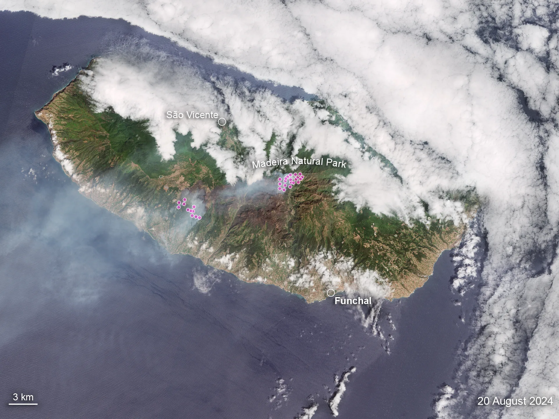
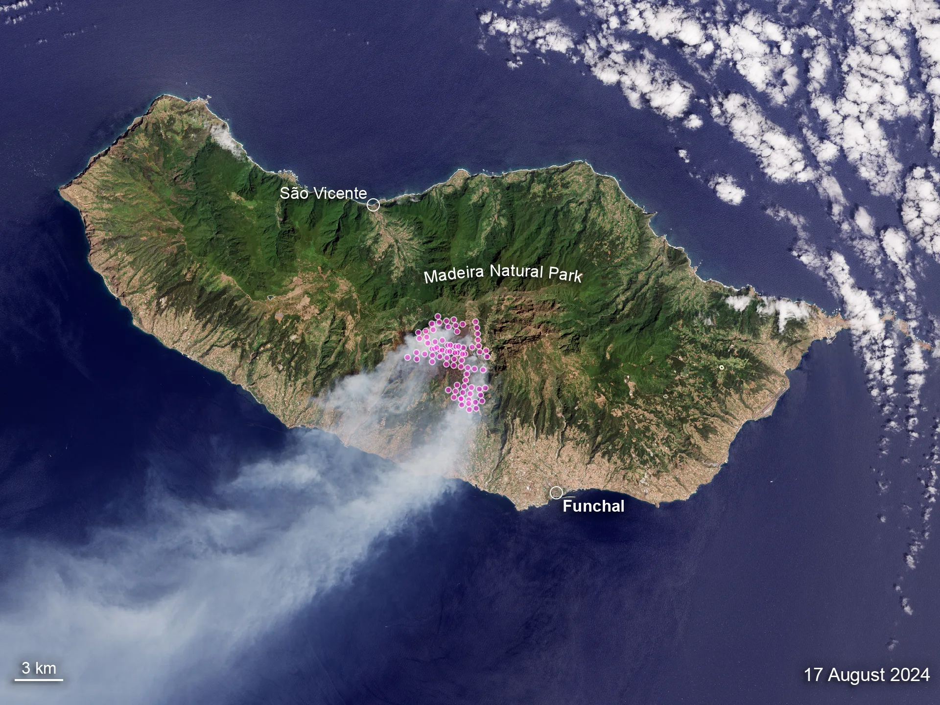
The image pair shows how the devastating fire spread from the center of the island near Serra de Água on 17 August, moving towards the southwest and northeast by 20 August.
Fire pixels from the VIIRS instrument (Suomi-NPP satellite) have been overlaid to help identify the active fire fronts.
Important: The overlaid fire pixels represent data from the entire days, while the images are acquired in the mornings.
17 Aug 2024 · Landsat-820 Aug 2024 · Sentinel-2
Propagation of the forest fire between 17 and 20 August 2024. Credits: USGS/Copernicus Sentinel-2
📅 As of 23 August, the fire had burned more than 5,700 hectares (57 sq km).
Credits: USGS for the Landsat-8 image of 17 August, Copernicus Sentinel-2 for the image of 20 August, and NASA FIRMS for the VIIRS fire pixels on both dates.